Cincinnati’s Riverfront: The Banks Urban Design Plan
For more than two decades, Cincinnati has invested in transforming its riverfront into a civic and cultural destination. While those efforts established The Banks as a premier sports and entertainment district, much of the riverfront’s potential remains unrealized. The Banks Urban Design Plan provides a coordinated framework to complete that vision—guiding future investment, increasing residential density, and creating a vibrant mixed-use neighborhood that reconnects the city to the Ohio River.
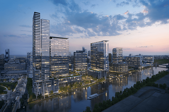
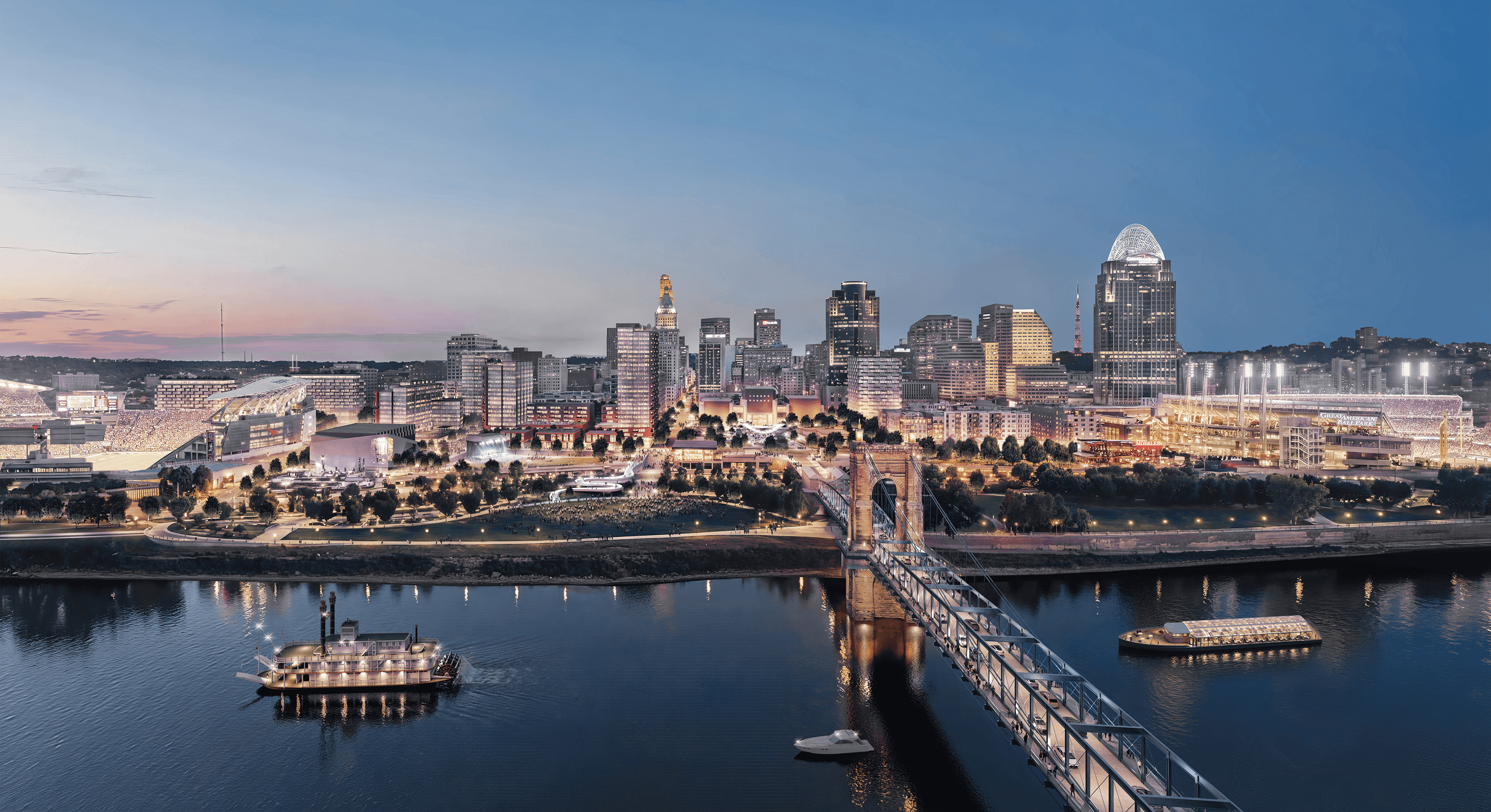
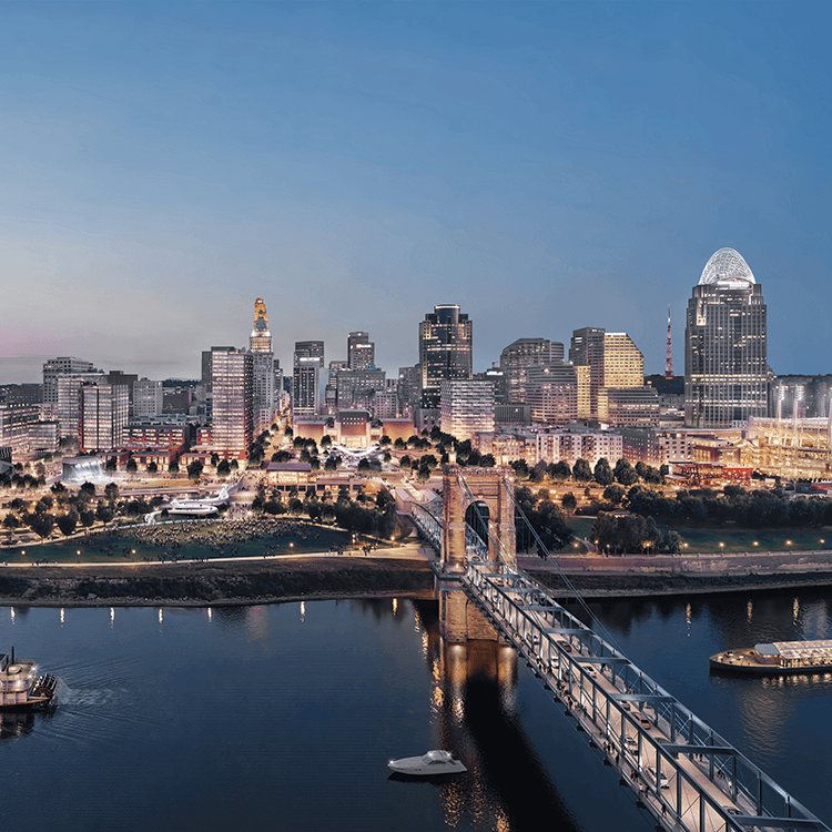
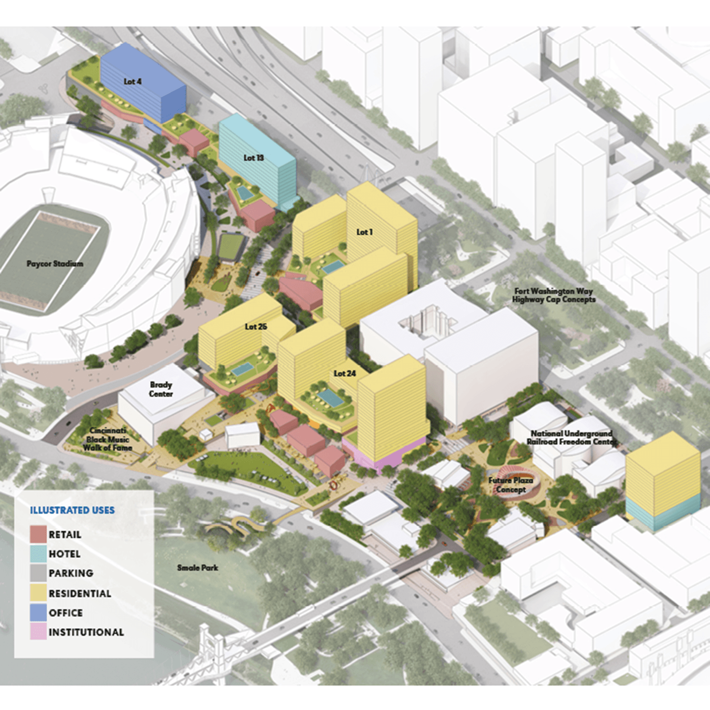
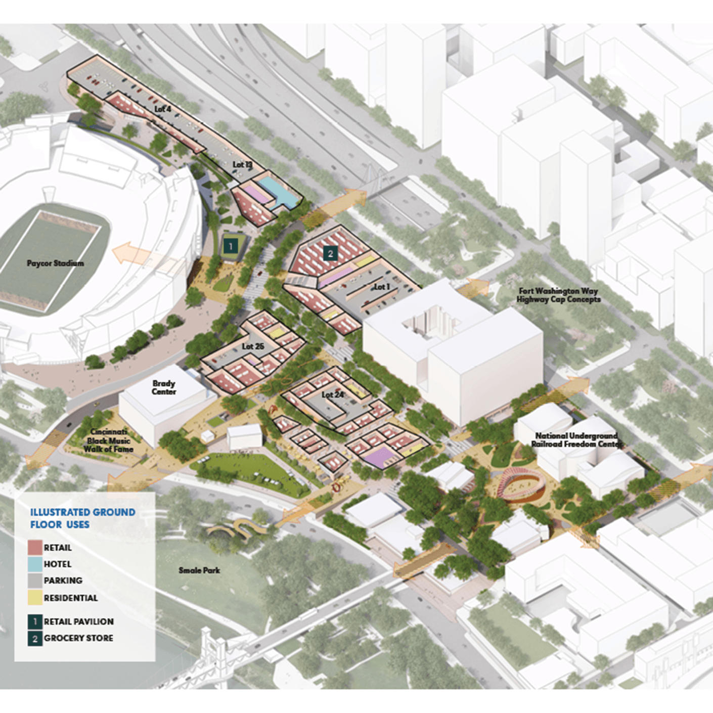
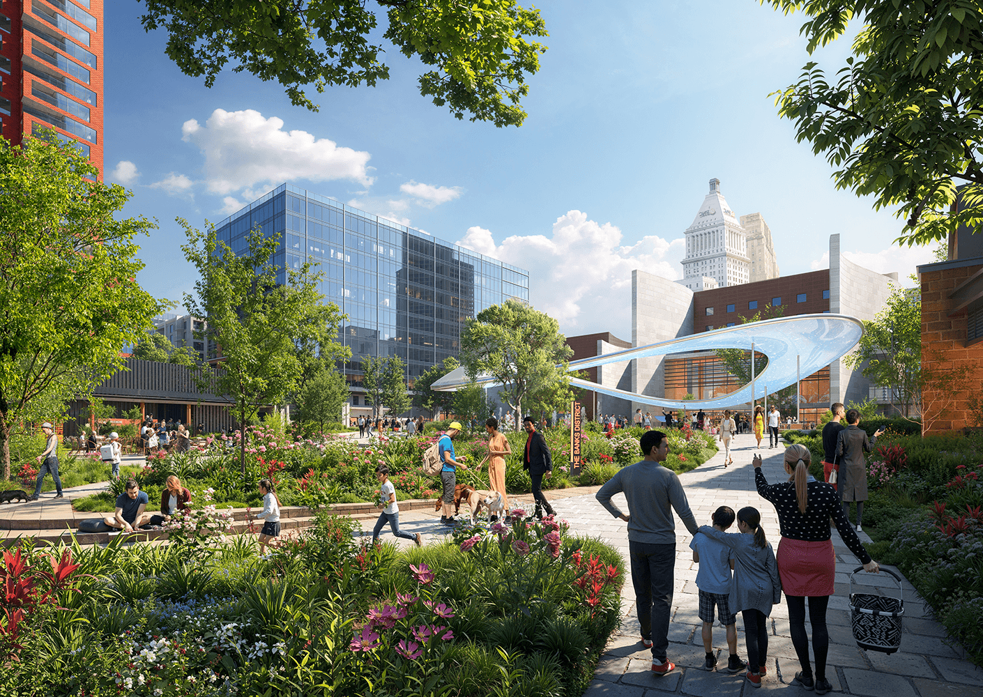
Developed in partnership with the City of Cincinnati, Hamilton County, Cincinnati Parks, the Cincinnati Reds, and the Cincinnati Bengals, the plan reimagines 18 acres of underutilized land between downtown and the riverfront. Building on the success of existing destinations—including Paycor Stadium, Great American Ball Park, Smale Riverfront Park, the Brady Music Center, and the National Underground Railroad Freedom Center—the plan establishes a framework for more than 2.5 million square feet of residential, hospitality, retail, office, and entertainment use. New public spaces, mobility connections, and resilient infrastructure create the foundation for a walkable neighborhood that completes one of the nation’s more significant riverfront revitalization efforts.
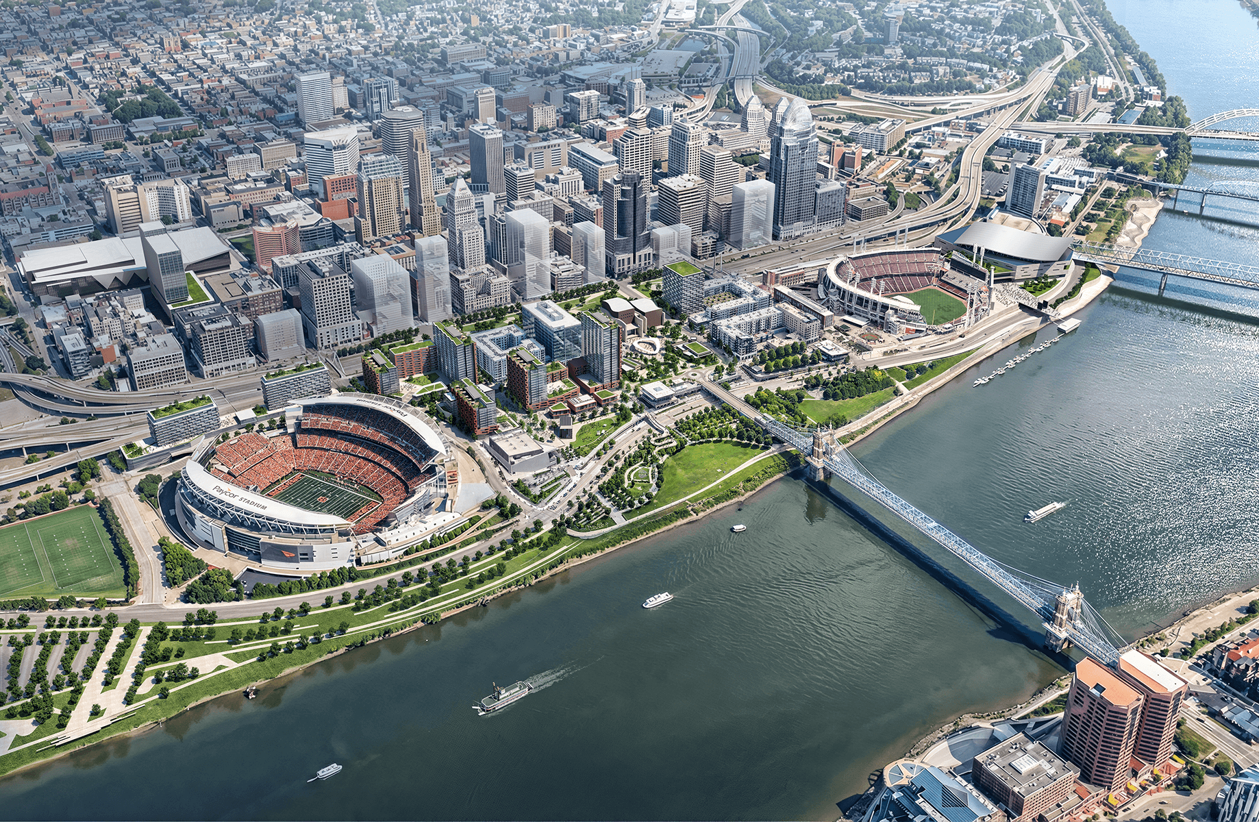
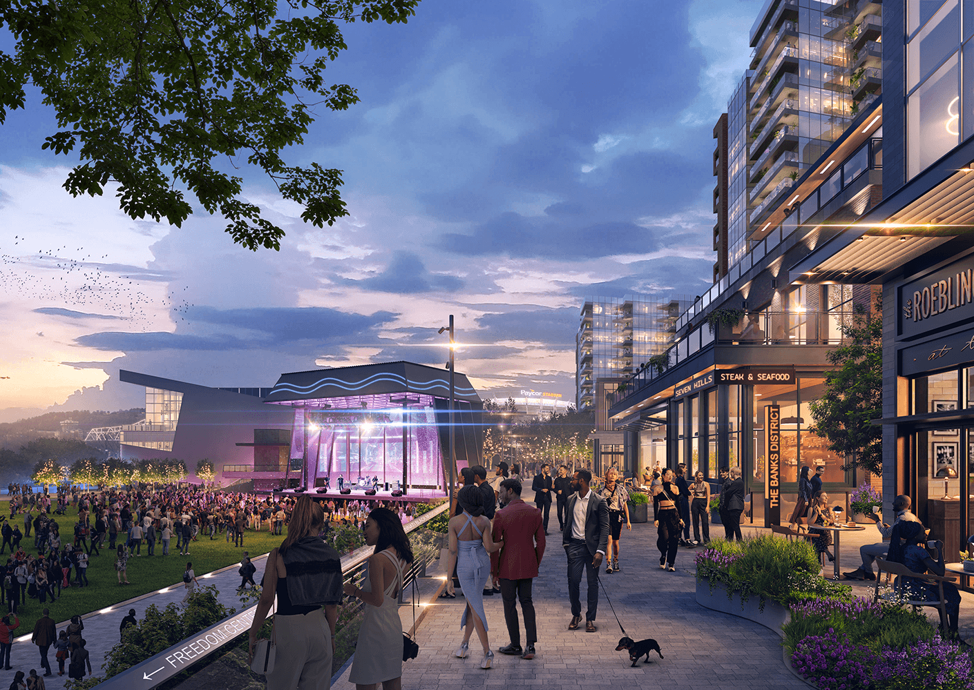
The updated plan expands The Banks into a more complete urban district by layering residential, hospitality, office, retail and civic space into a cohesive riverfront neighborhood. With more than 2.5 million square feet of new development, including significant residential density and new high-rise living, the district is positioned to bring thousands of new residents to the riverfront.
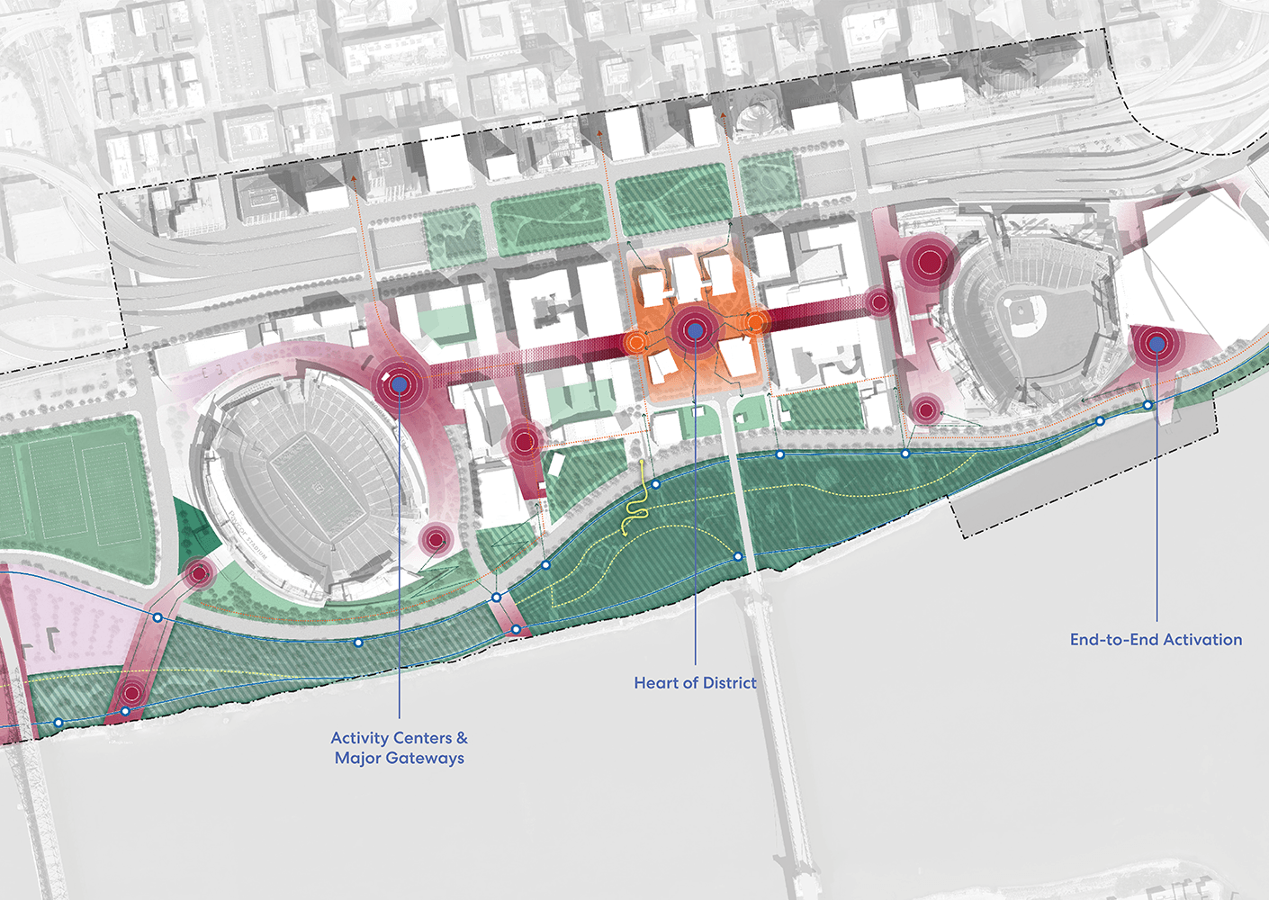
At full buildout, The Banks will become a fundamentally larger civic and economic engine for Cincinnati, strengthening the connection between downtown and the Ohio River while amplifying the role of the riverfront as a regional destination. New development parcels are organized to create a stepped urban edge that transitions from downtown toward the river, reinforcing both scale and legibility within the city’s skyline.
The Banks will become Cincinnati’s front door, welcoming millions of visitors each year for sports, concerts, and cultural events. Yet much of the district was designed around peak attendance for sporting events rather than daily neighborhood life.
The master plan introduces substantially increased residential density and mix of uses needed to support a true neighborhood. New housing, including landmark residential towers, brings thousands of residents to the riverfront, creating a critical population base that supports local businesses, activates streets and public spaces, and strengthens the district’s long-term economic vitality. By layering residential, hospitality, retail, and entertainment uses together, the plan shifts The Banks from a destination people visit to a neighborhood people inhabit.
Phil Beck, project executive, The Banks Public Partnership
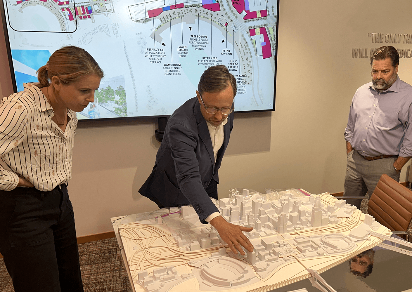
The Banks is envisioned as a coordinated, high-quality urban district where public realm investment and private development are aligned to generate long-term value. Rather than isolated projects, the plan establishes a framework for phased implementation—ensuring each stage builds momentum, connectivity, and place identity.
Strategic investments in streets, open space, and infrastructure are central to this approach. Together, they elevate the performance of surrounding development while supporting a consistent district experience. Public spaces—including a signature civic plaza fronting the National Underground Railroad Freedom Center—anchor the plan, reinforcing the relationship between civic identity, cultural memory, and economic vitality.
The result is a district designed not only for growth, but for sustained value creation through quality, coordination, and place-based investment.
Project Team


Related Content