Future of Design January 14, 2026

These community advocacy groups influenced Boston’s biggest project since the Big Dig

Riverside park with walking paths and kayakers, lush trees along the waterfront.
Built starting in the mid 20th century, elevated freeways prioritized the needs of commuters over urban dwellers, often to the detriment of the neighborhoods they ran through. Along with many other cities, Boston is currently planning to replace a section of elevated freeway. But it can be difficult for the community to have a voice in these massive and complex infrastructure projects. In the case of the Allston Multimodal Project, a little help from an altruistic design team gave advocates a clear vision that they could rally around at a pivotal moment.

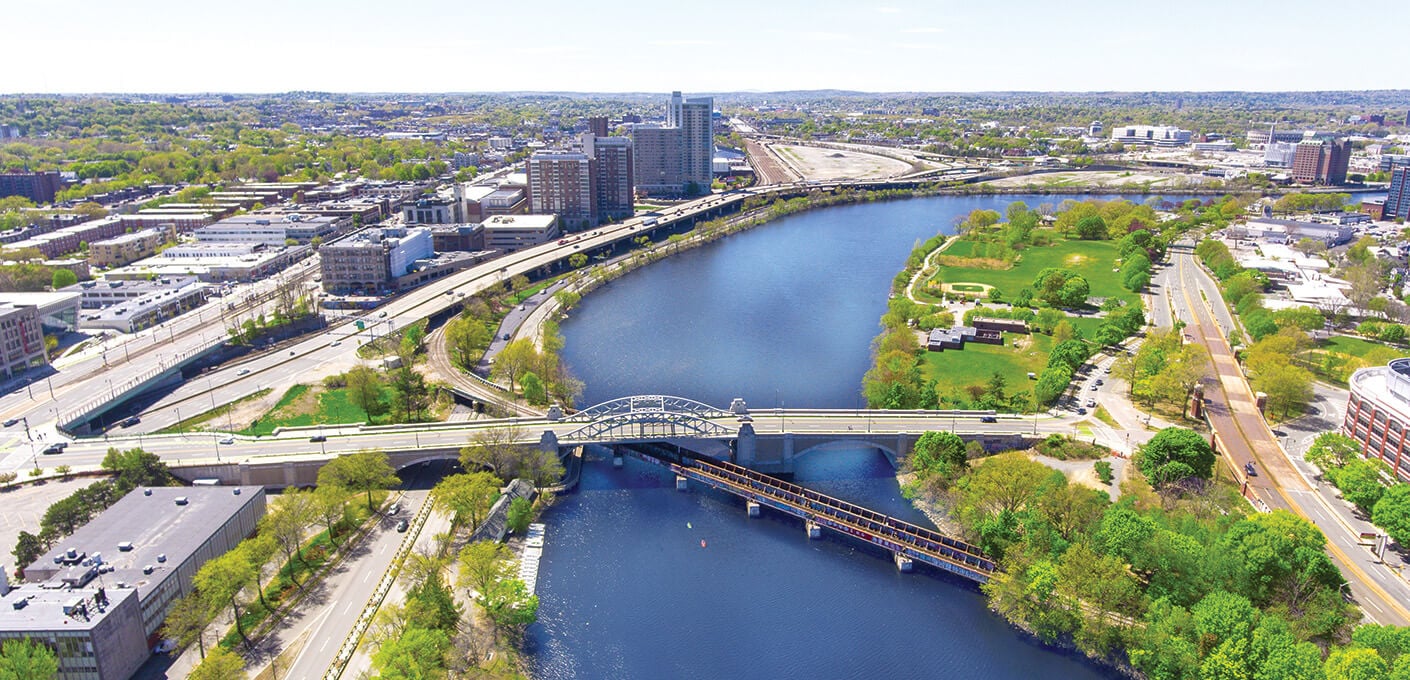
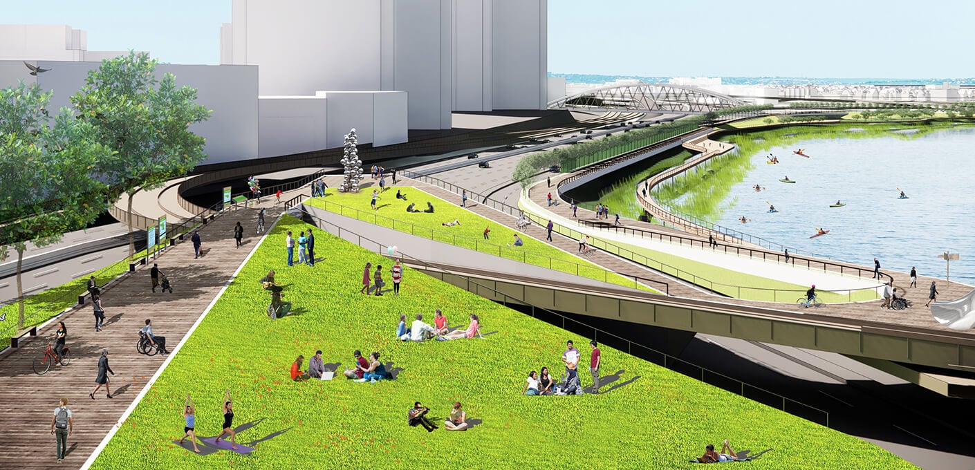
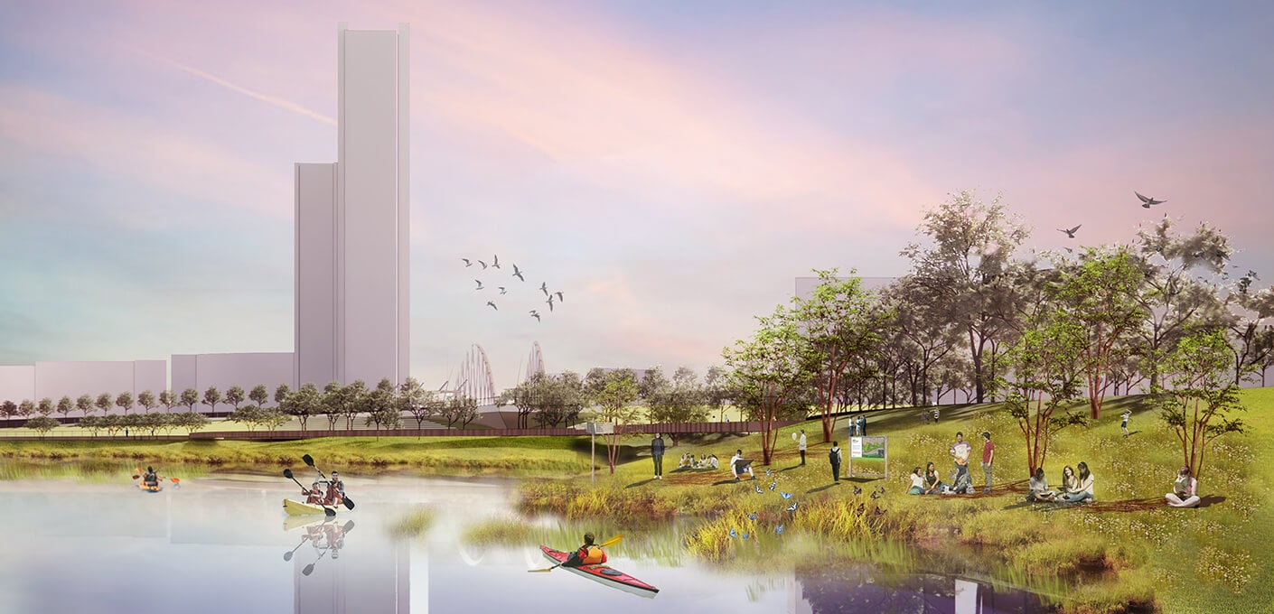
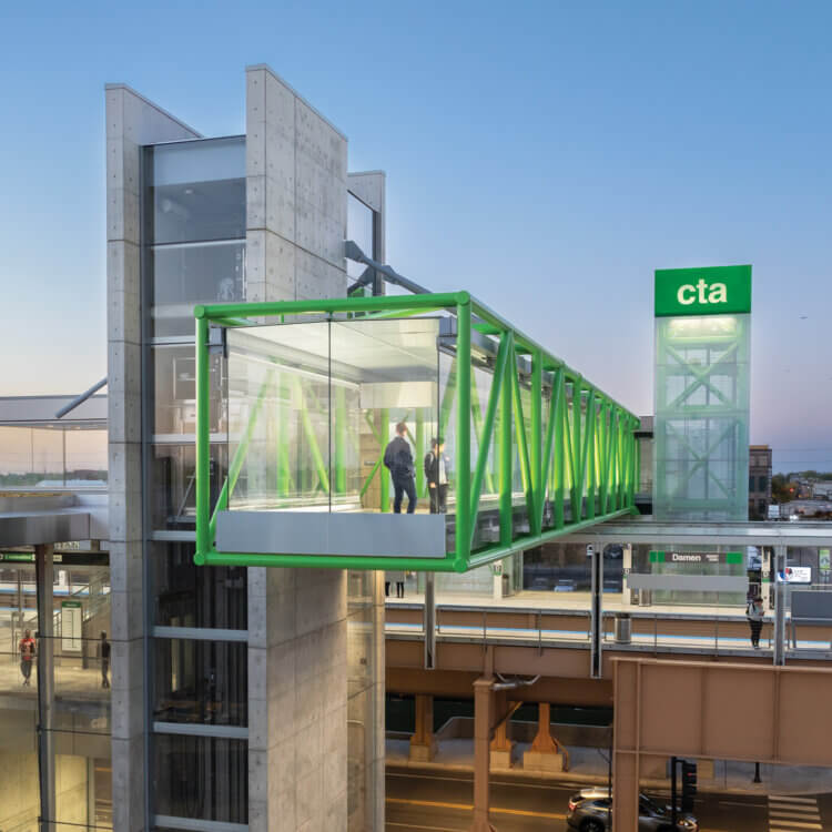
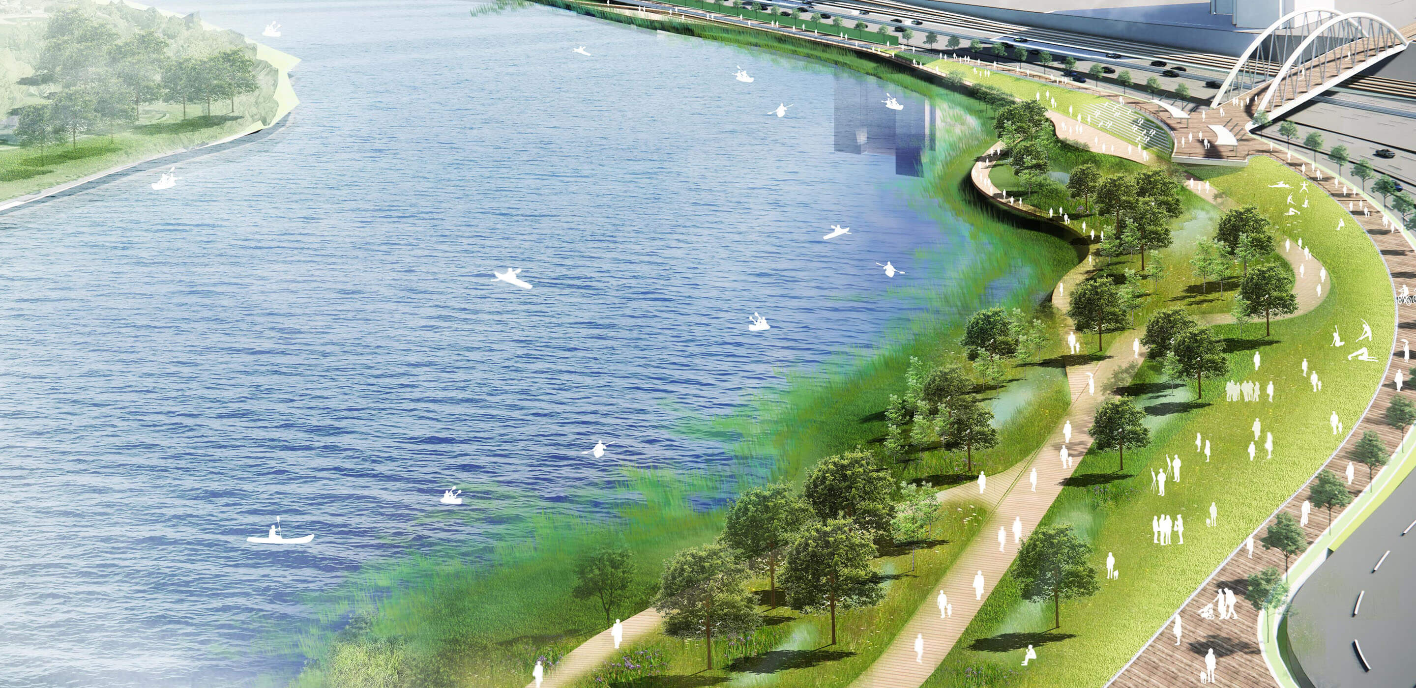
Previously, in a notoriously lengthy project known as the Big Dig, Boston had relocated its elevated Central Artery underground, alleviating severe congestion and reclaiming land for precious open space downtown. In 2013, the state began planning to replace the dilapidated viaduct that elevated Interstate 90 through the Allston neighborhood, about three miles west of downtown. Key to the project is a half-mile section known as “the throat,” where I-90, a surface road, two commuter rail lines, and a bicycle and pedestrian path all converge next to the Charles River. Upgrading this infrastructure, an estimated $1.9 billion project, offers the potential to improve bicycle and pedestrian routes; vastly improve access to the waterfront; and redevelop part of Beacon Park Yard, an approximately 100-acre site along the riverside owned by Harvard University.

Aerial view of river, bridges, and green space in urban cityscape.
The half-mile section known as “the throat.”

“There’s a four-lane highway [in each direction] dividing the neighborhood from the river, so connectivity to the river is really bad,” says Harry Mattison, who has lived in North Allston for 30 years and is one of the leaders of People’s Pike, a residents’ advocacy group. Mattison understood that, since the state department of transportation (MassDOT) owned the project, it would naturally have a highway-centric focus. For several years, the plan leaned toward preserving the status quo: replacing the degrading viaduct with a new one. But he and other residents wanted to bring their priorities into focus.

In 2018, urban designer Gautam Sundaram joined the board of the Charles River Conservancy, one of many advocacy groups following the Allston Multimodal Project with keen interest. Sundaram soon got up to speed on the situation: There were nearly 30 distinct communities and advocacy groups who had concerns about the project. But they often had competing priorities, sometimes even within individual groups. And the groups were having trouble finding consensus in the workshops held by the public agencies in charge.

In spring of 2020, Sundaram began working with community stakeholder groups to create a vision for the throat in collaboration with Kishore Varanasi, an urban designer from another local architecture firm. The design team pulled together key information about the riverine environment and advocates’ concerns in a matter of months. They focused on the Charles River and the problems facing the urban waterfront, including sea level rise, poor water quality, and unequal access to the water.

Render of urban park by a river with people biking, walking, and relaxing on a sunny day.
By removing the viaduct and putting the highway at grade, the city could have an accessible, living shoreline.

“The design team did some amazing work, partnered with us, and talked to a lot of different people,” Mattison says. “They created an alternative vision. As professionals, they could validate some of the intuitions that we had, which was that we could get something better than what we were being presented with. They said, ‘Let’s look at it from a different point of view’­—which was not, ‘How many hundreds of thousands of cars a day do our traffic models think need to drive from here to there?’—’Let’s think about what would be best for the river and for the people who want to enjoy it and bike along it.’ Their work definitely increased the visibility of the river’s edge, as well as MassDOT’s responsiveness, attention, and care to those issues.”

In October 2020, MassDOT released a document that outlined the advantages of replacing the viaduct. That month, the design team completed its analysis and began reviewing a vision for the transformation of the waterfront with various neighborhood groups and nonprofits. By removing the viaduct and putting the highway at grade, the city could have an accessible, living shoreline, with wetlands that buffered the city against the impacts of climate change.

“They did these incredible renderings to illustrate—for a vast array of stakeholders—what the design could look like, and how it would open up access to the river, restitch the Allston neighborhood, and offer connectivity for the entire region,” says Kate Dineen, president and CEO of A Better City, a nonprofit that represents the business community of Boston. “It was a human-centric look at what is often a really confusing megaproject for people. So having these renderings be part of the conversation was a galvanizing moment. People started to be able to envision themselves in the landscape and to see how this specific design would impact them and transform the city for the better. I don’t think we would be where we are today without that work.”

Render of green park with people, pond, trees, butterflies, and a viewing platform.

Bolstering efforts to move the needle, A Better City partnered with the Conservation Law Foundation to take out a full-page ad in the Boston Globe in November 2020, urging the governor of Massachusetts to select the at-grade option. The centerpiece of the ad was one of the design team’s renderings. Several years later, A Better City also featured the design team’s renderings in a brief advocacy video.

In early 2021, the design team released a concise, 15-slide presentation titled “The Charles River: A Living Shoreline.” It was the culmination of all the research and outreach, and it powerfully articulated the shared vision. In stark contrast to photographs of the existing elevated highway, choked with cars, there were renderings of an idyllic, natural river edge populated with shorebirds and kayakers. Sundaram became a regular spokesperson for the vision, giving the talk at least 30 times to stakeholders and decision-makers, and various advocacy groups began circulating it widely.

With so many elected officials and community organizations saying the same thing loud and clear, MassDOT announced that it was selecting the at-grade option in September 2021. Today, the project faces the hurdles of getting through an extensive environmental review, as well as securing enough funding.

But the vision is anchored in place, the stakeholder coalition remains intact, and the Commonwealth of Massachusetts and City of Boston are committed to advancing this transformational project. “It’s really difficult to build coalitions and to keep people engaged without having an illustration of the future end state,” Dineen says. “It helps to inspire and remind people, when the fight gets long, of why we are doing this and what we’re all moving towards.”

Render of a park scene with people kayaking, relaxing under trees, city skyscrapers in the background.
“It’s really difficult to build coalitions and to keep people engaged without having an illustration of the future end state. It helps to inspire and remind people, when the fight gets long, of why we are doing this and what we’re all moving towards.”
Kate Dineen, president and CEO of A Better City