Perspectives August 8, 2019

The Sprint: ResilientSEE Charles River

By Ryan Kurlbaum
MIT Riverwalk
What if MIT Riverwalk was anchored by a progressive community sailing workshop? The Charles River is illustrated with Social (pink), Environmental (green), and Economic (blue) amenities.

If we were honest, some architectural internships could use a refresh.

Firms across the country are flooded with eager students applying each spring. After numerous career fairs and countless interviews, few are chosen for summer employment. Younger staff are embraced by their colleagues and engage in many office events, but it seems finding a way to leverage their unique skillsets – especially during a 3 month period – is difficult.

The question becomes – how does the contemporary architectural practice engage summer interns in a way that promotes their skills, encourages learning, and provides office exposure?

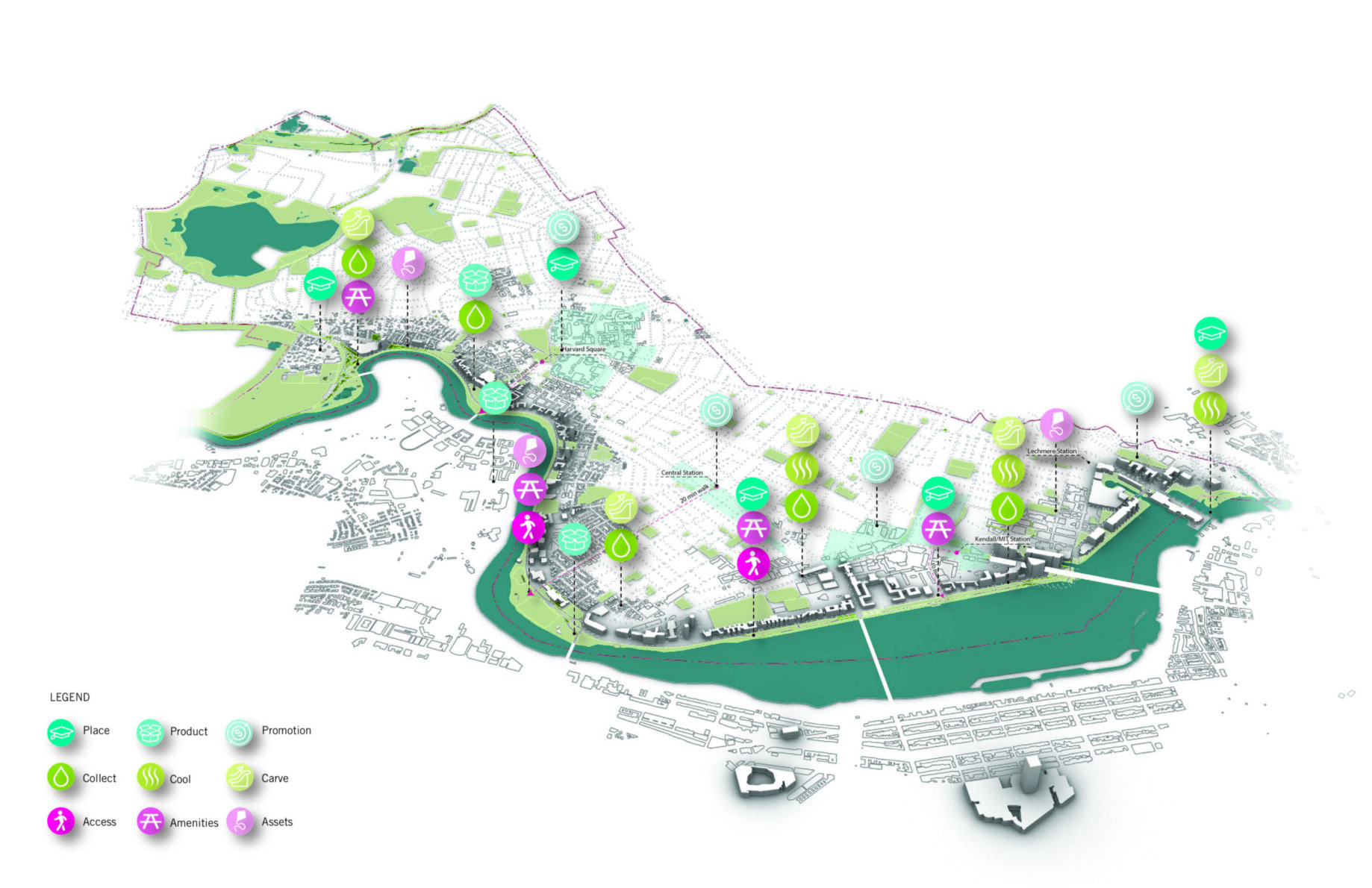
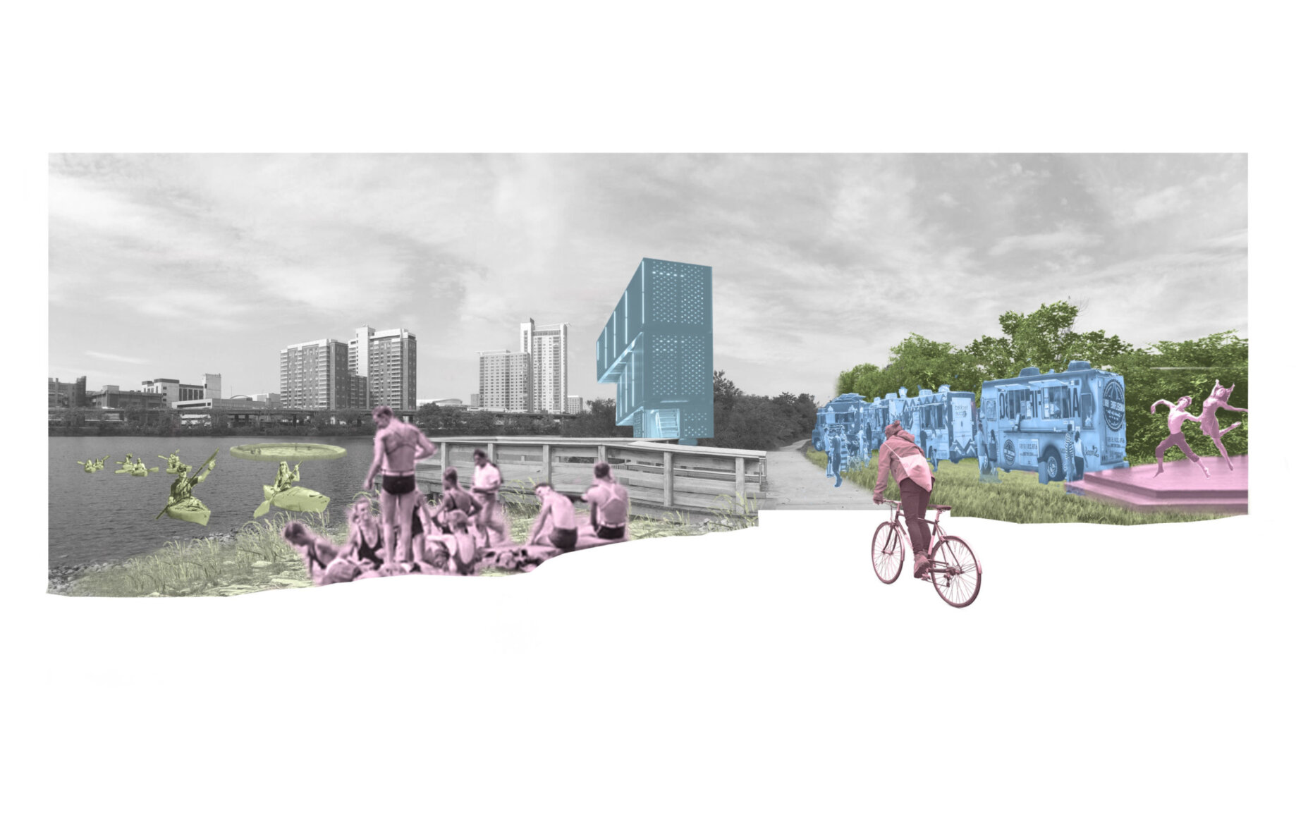
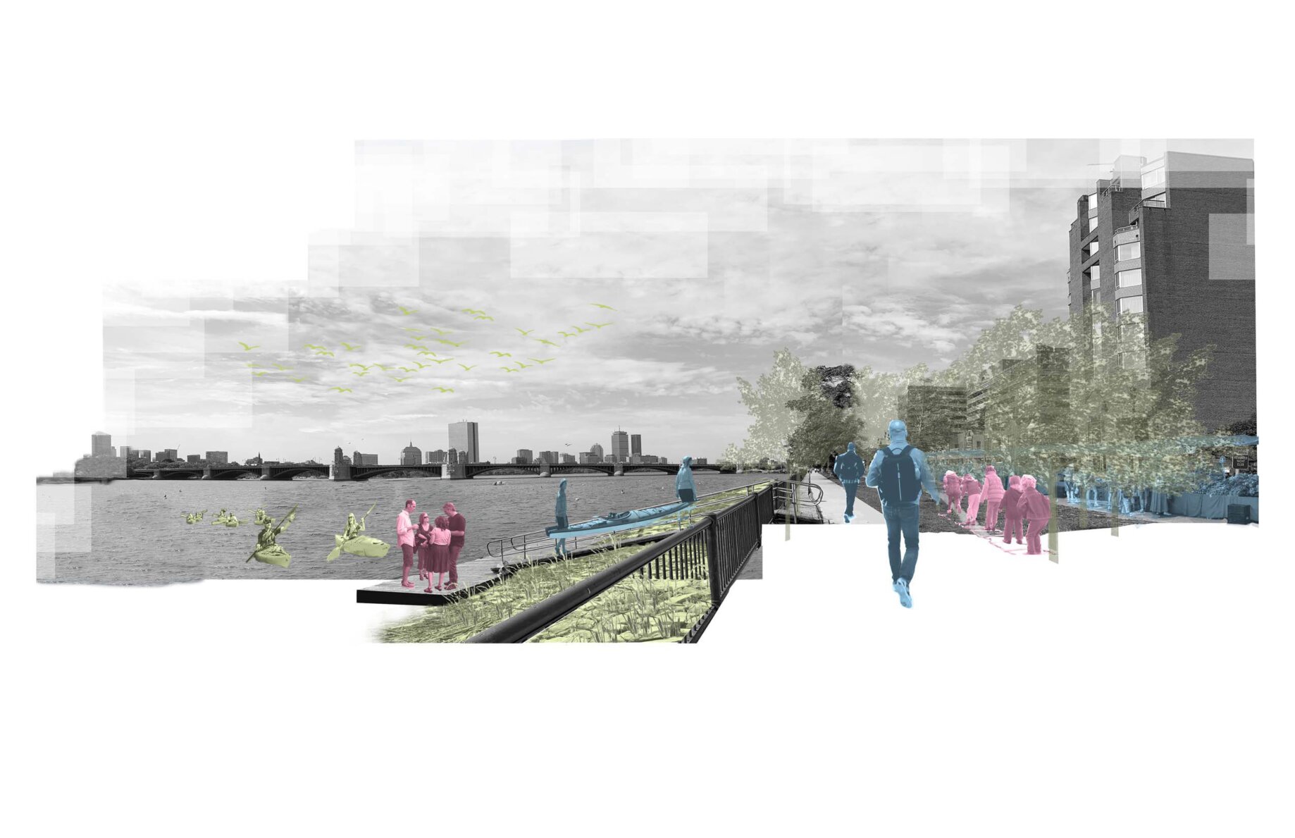
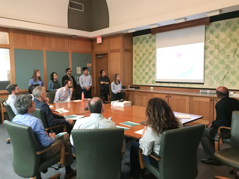
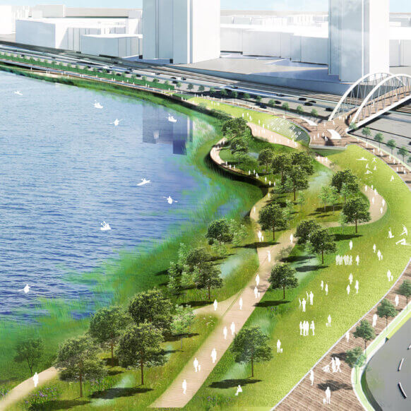
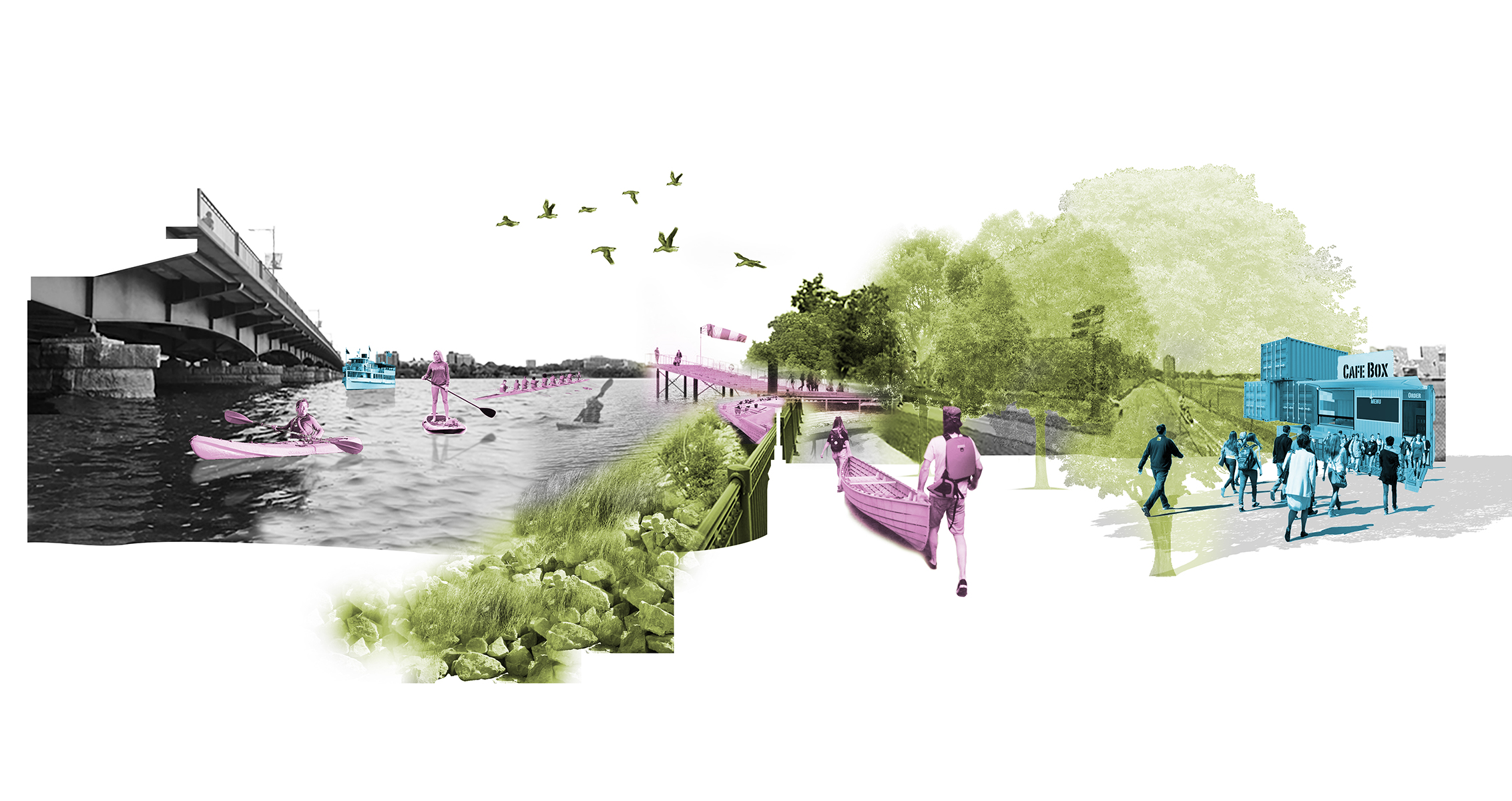
We sought to change this paradigm by assigning our summer staff a quick design sprint – a group urban design problem on the Charles River. Working closely with the City of Cambridge and Department of Public Works, we created a unique opportunity for (6) summer interns to work together on a one-week design charette: How would the City of Cambridge benefit from a re-imagined Charles River?

The following details the findings of their research through the ResilientSEE design methodology – applying Social, Environmental, and Economic lenses to large-scale urban problems. In this case, we tied each lens to a design question and series of provocations intended to promote implementable and phase-able design interventions – a menu of urban strategies that over time add up to a legible riverfront urbanism.


The following details the conclusions presented by our summer interns:

3D rendering
Analysis of existing conditions along the Charles River through the S-E-E lenses. Pink circles indicate social features; green indicates environmental; and blue indicates economic.

01:         Social

Q: What are the vibrant and active places along the Charles? What makes these places successful?

Provocations:

  • Access– Necessary transportation must enable an individual to visit whether it be by walking, biking, carpooling, or even boating in the case of the Charles River.
  • Amenities – Proper shade, seating, dining opportunities, drinking fountains, and restrooms extend an individual’s journey from a quick trip into a premier social destination.
  • Assets – A site must have assets that entice an individual to visit. These assets range from historical, cultural, and educational moments to activities with city views and commercial interests.


02:        Environmental

Q: How does the built or naturalized environment hinder or enhance one’s experience?

Provocations:

  • Cool Areas where the heat island effect is the most prominent should become destinations in Cambridge. Dense tree canopies can be planted to cool pervious neighborhoods.
  • Collect –  Combined sewage overflow and impervious surface data indicates where water is impeded by infrastructure. Softer edges along the Charles can collect urban runoff, promote vibrant ecosystems, and riverfront interaction.
  • Carve – Historic geographic mapping and future climate analysis indicates natural hydrological flows – where the water wants to go. This overlay of historical and projected data illuminates potential sites to carve inlets and re-connection to the Charles River’s inherent movement.


03:      Economic

Q: How do current economic drivers encourage future economic growth along the Charles?

Provocations:

  • Place – New economic engines and public events can be organized around existing assets – MBTA stops, campuses, corporate hubs, kayak docks, boathouses, pavilions, etc.
  • Product – What types of products would serve each site well? (kayak rental, food trucks, concert pavilion, pop-up shops, etc.)
  • Promotion – Re-occuring public events or seasonal activities could engender future economic growth in the area – concentrating on Magazine Beach as a pilot site for recreation, boating economies, and open street and music festivals.
Beach Composite
The interns analyzed opportunities at three different locations along the Charles River. This rendering shows how Magazine Beach could become the most popular urban beach in New England through a series of Social (pink), Environmental (green), and Economic (blue) interventions.
Cambridge Parkway
Could the Cambridge Parkway become the highest-grossing urban riverfront on the East Coast? See above for Social (pink), Environmental (green), and Economic (blue) assets.

Next Steps

Following their analysis, the group presented their insights and ideas to the City of Cambridge and Department of Public Works, receiving an overwhelmingly positive response. We’re convinced that design sprints like ResilientSEE: Charles River have the potential to strengthen and foster new partnerships with city officials. The content, graphics, and presentation of this year’s summer interns were compelling and captivating. Clearly, this design charette model offers an intensive and comprehensive introduction into the S-E-E design process – a way to “kick the tires” on this unique planning and design framework. ResilientSEE Charles River illuminates a convincing strategy to allow summer interns to gain office exposure, create invaluable experience, and leverage their unique abilities and skill.

Special thanks to our Design Leaders: Yanel de Angel, Gautam Sundaram, and Arlen Stawasz. HR coordination and support from Kim Wong.

And our fantastic summer 2019 interns, Eleanor Bennett, Kristabel Chung, Jake Crociati, Daniel Fernandez-Barbara, Chris Gallegos, and Ashley Johnson.

Interns presenting to City officials.
Interns
Our summer intern group.