Digital Innovation
The synergy of design, research, and technology fuels our work to enhance the built environment. Our dedicated digital innovation team ensures the latest advancements are integrated across our design process, maintaining our leadership in delivering excellence.
We are a transdisciplinary team that goes beyond Building Information Modeling (BIM) by integrating digital solutions throughout the entire architectural design and delivery process, and further, by addressing our clients’ new challenges at the intersection of data, devices, and the built environment.

Our resilient and secure cloud infrastructure platform facilitates seamless collaboration among our design teams, consultants, and most importantly, clients, fostering connections, collaborations, and innovation.


We revolutionize architectural design through advanced parametric modeling and environmental analysis. Our custom-developed applications—including Scorridors, Campus Planner, Airformer, and AreaSync—leverage AI, geospatial data, and data analytics to address our clients’ new challenges while delivering unparalleled value.
We embrace cutting-edge technologies like computational design and artificial intelligence (AI), which are crucial components of our design process. This approach builds upon our design teams’ rich experience and intuition using advanced computational, parametric techniques and AI algorithms to harness site-specific data, sustainability goals, and client-specific parameters.
Such a combination not only streamlines the design and delivery process, improving speed to market, but also leverages AI to analyze patterns, predict outcomes, and optimize solutions. This strategy broadens the range of design options, increases efficiencies, and empowers our clients to make smarter, quicker decisions.


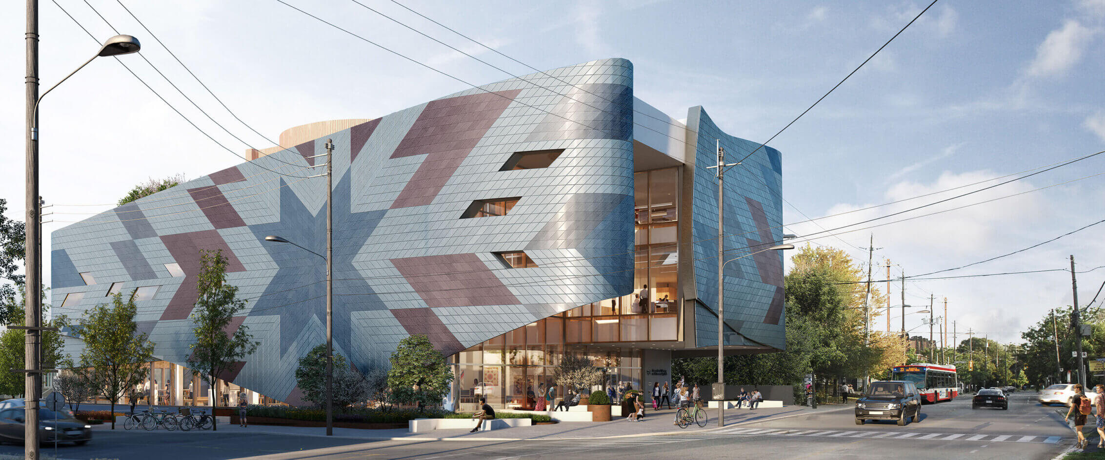
Our efforts to combine advanced technology with sustainable practices have been recognized with industry awards, including the 2023 Best Sustainable Firm title by Architizer. To further amplify our impact on projects of all sizes, sustainability targets are embedded and measured throughout our design process.
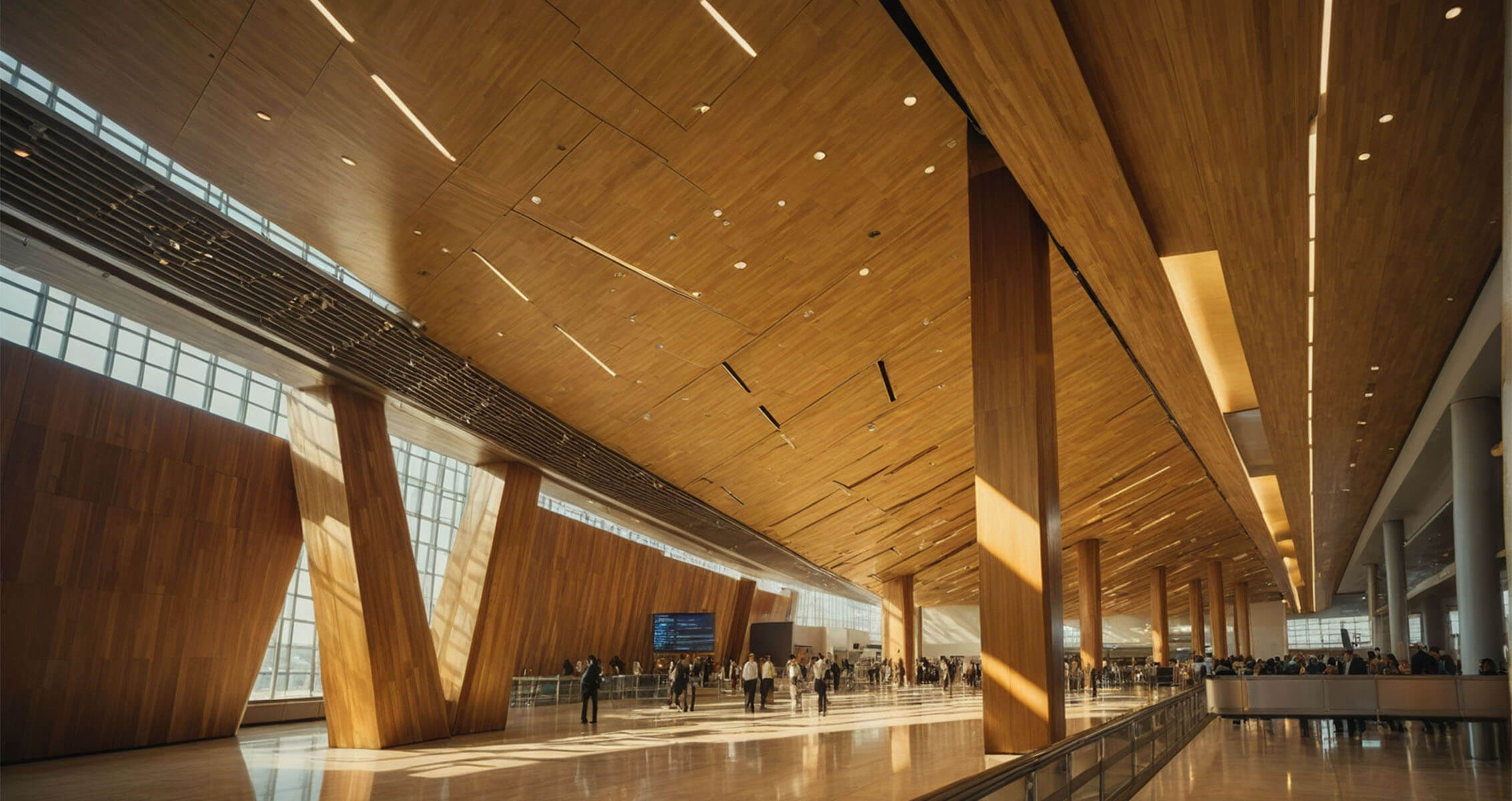
All of our designers have access to powerful computing tools that enable them to conduct real-time simulations on their laptops. These simulations mimic real-world conditions, such as daylight, temperature, and wind speed, allowing designers to assess how well a design aligns with sustainability goals. Early environmental simulations are crucial not only for understanding how future inhabitants will experience the space but also for setting and achieving our ambitious sustainability targets.
This approach ensures that each project progresses seamlessly from concept to reality, and is delivered on time and within budget.
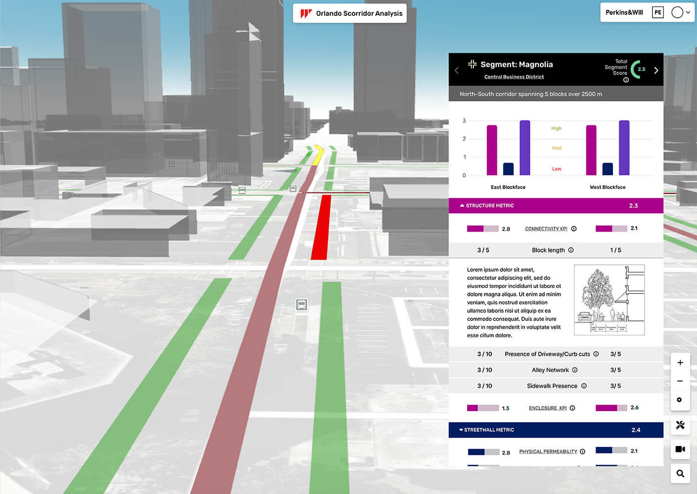
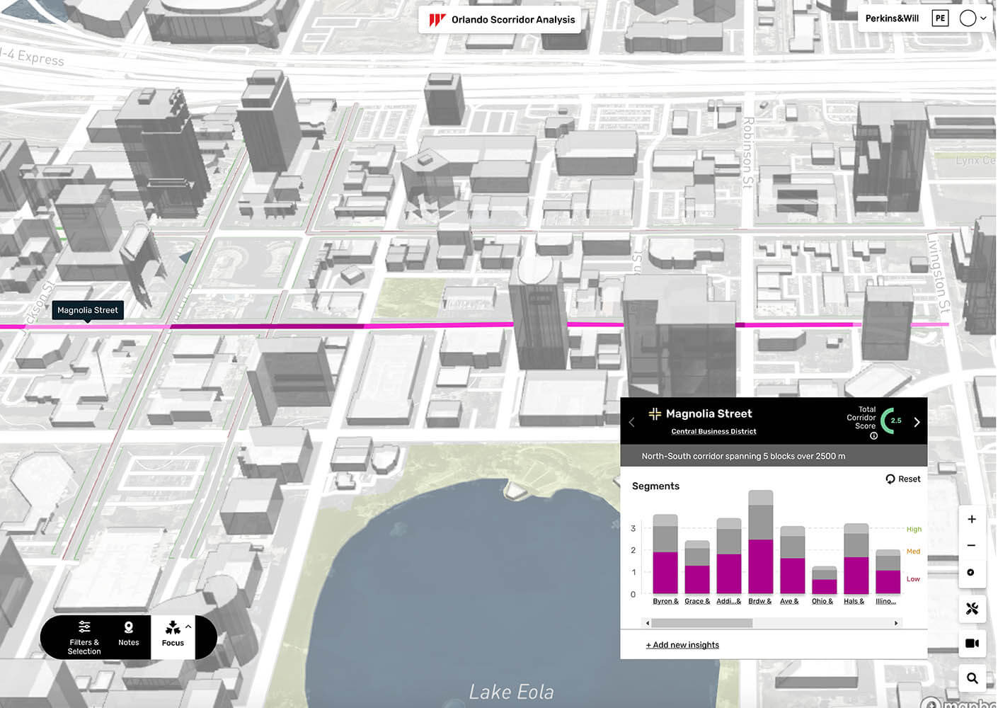
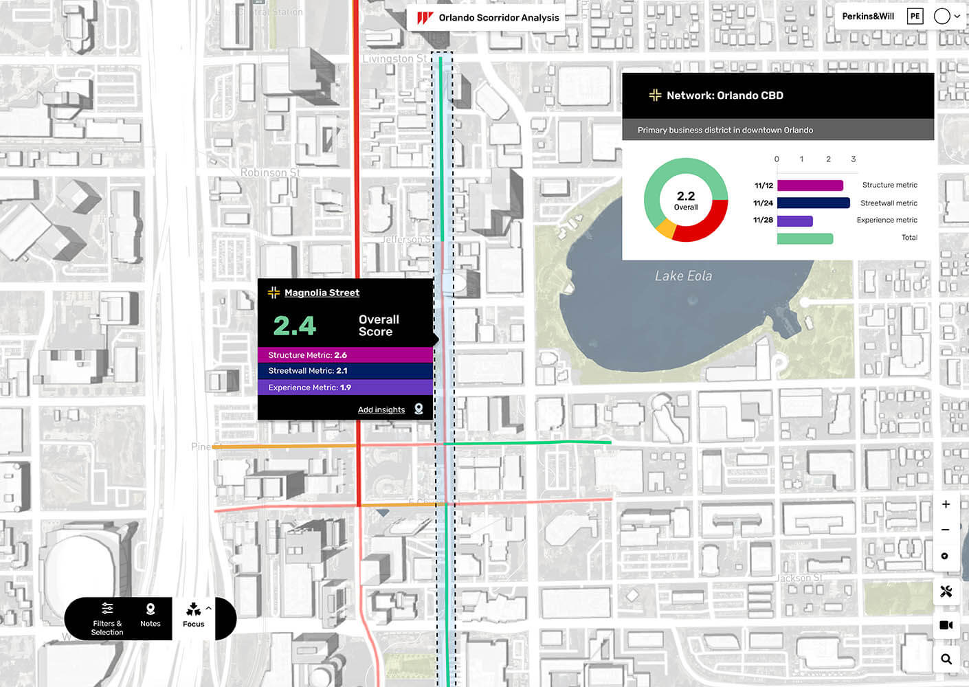
A vibrant public realm has a connected structure that encourages walkability, an active street wall edge that provides architectural interest and destinations, and a comfortable pedestrian experience that is enjoyable, exciting, and safe. StreetSeen provides reporting and scenario building tools based on spatial analytics, for a collection of measured data points. Each blockface is measured across dozens of indicators to create three metrics: structure, streetwall, and experience. Each metric combines for a corridor rating system based on peer reviewed processes, engineered by our urban designers and data scientists.
For nine decades, we’ve navigated numerous technological advancements in architectural design and delivery. In this rapidly evolving era, we recognize the potential of AI and machine learning (ML) to impact on our profession.
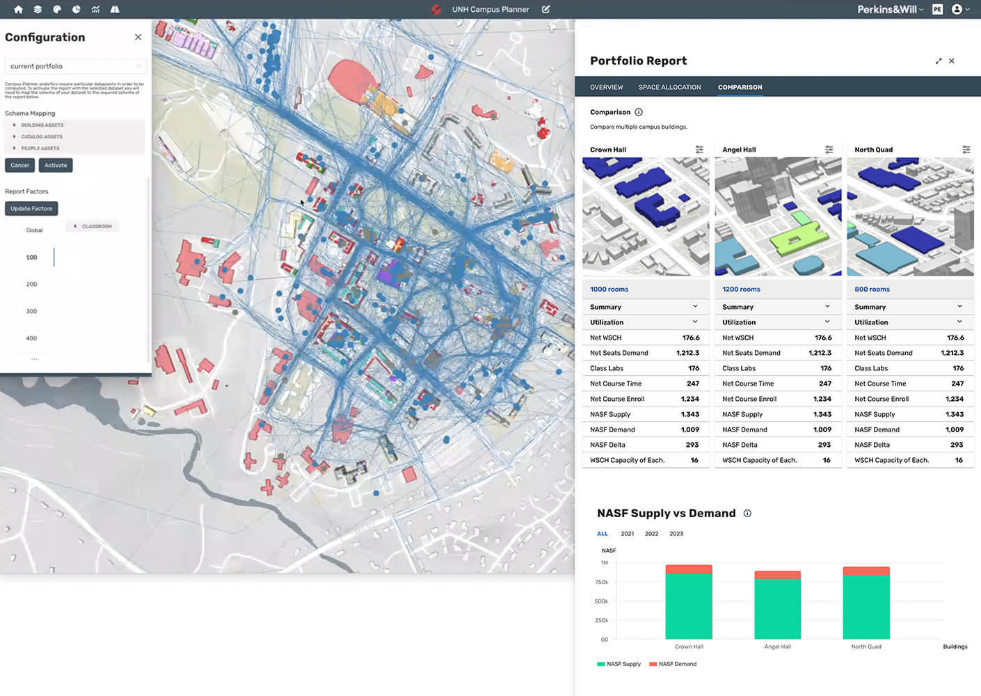
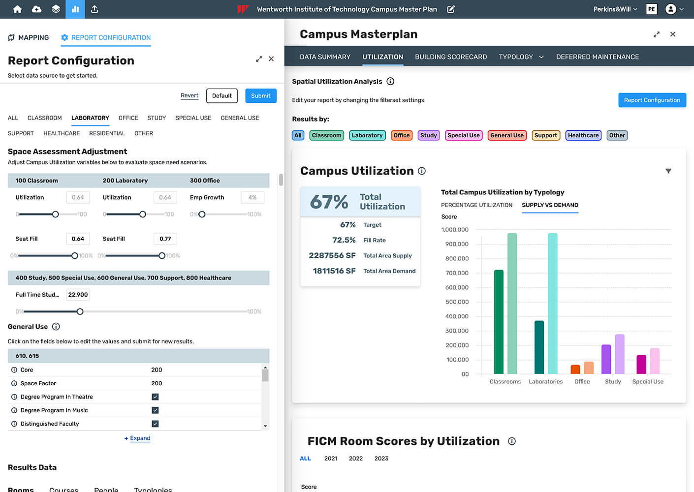
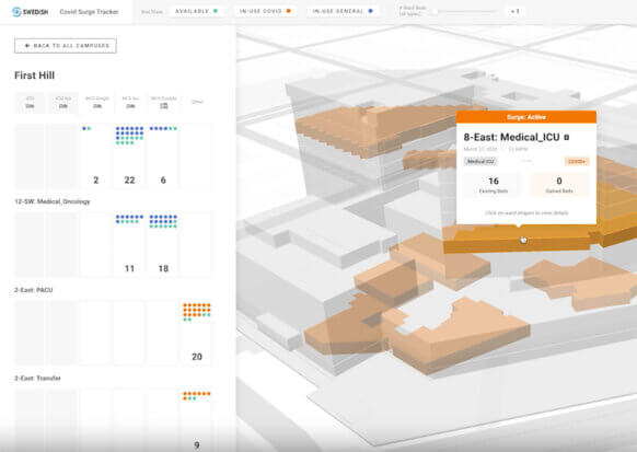
Campus Planner is a tool developed by Perkins&Will that allows our design teams to synthesize large amounts of data (i.e. space utilization, course schedules, enrollments, GIS filters), and visualize it on a map. The mapping platform makes it easier to visualize the “full picture” of building assets, including their use and occupancy. This makes it possible to quickly understand opportunities for consolidating, repurposing, or removing buildings.
The tool’s visual format makes it is easy to work through multiple scenarios quickly, and in a way that university planners and leadership can easily understand. Because it’s tied to a GIS system, we can continue to add data to the campus map that helps inform different elements of master planning, like streets, buildings, or vegetation data. Because it’s live, we can plan in real-time. This planning tool is not a report collecting dust on a shelf. It’s dynamic and can be easily updated as data inputs change. Campus Planner allows teams to make decisions in real time, track projects, and benchmark against key performance metrics and targets.
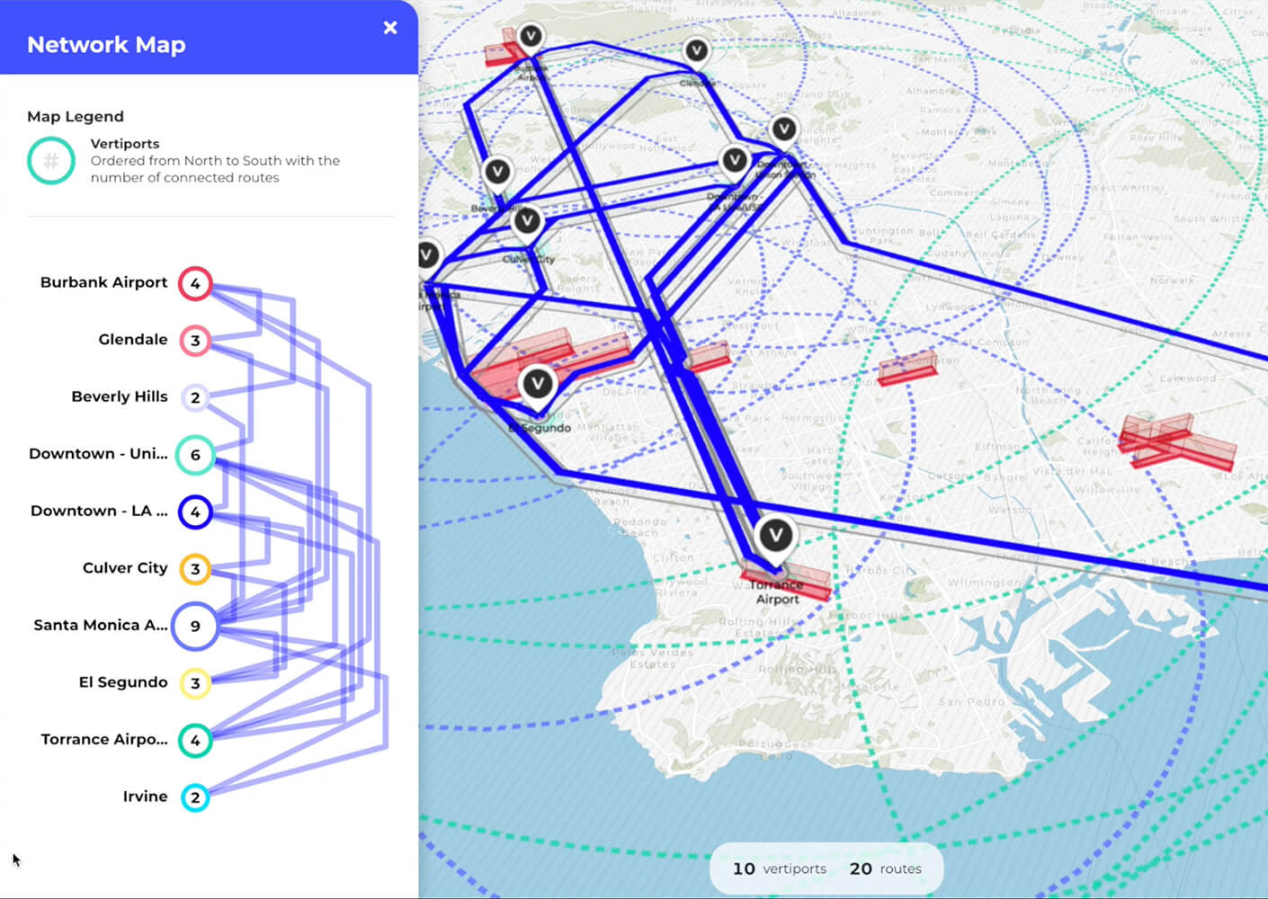
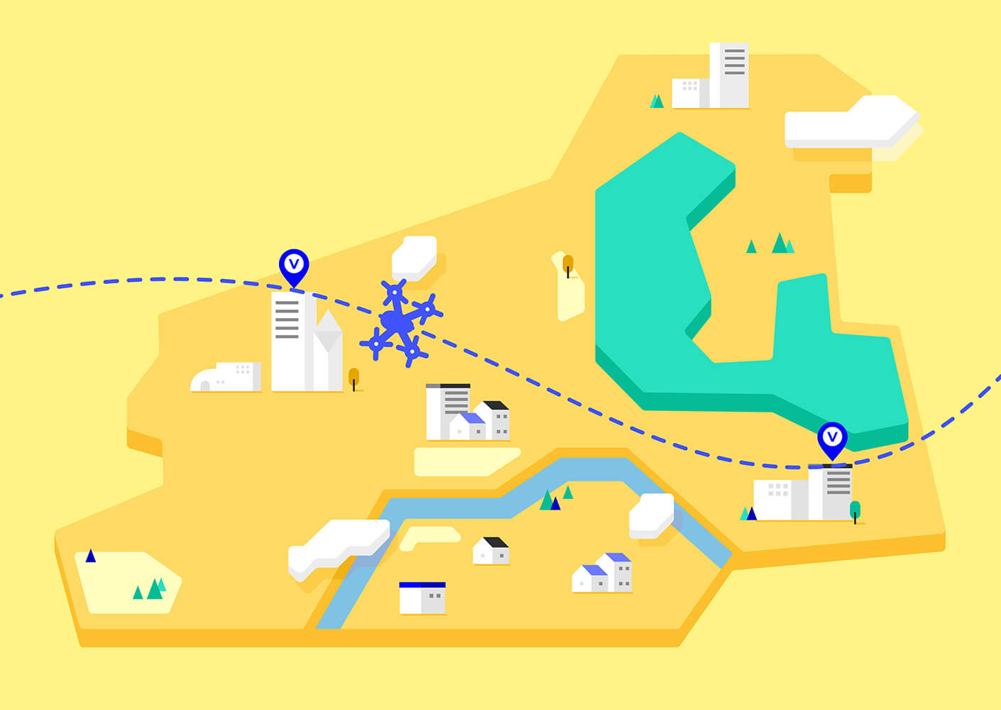
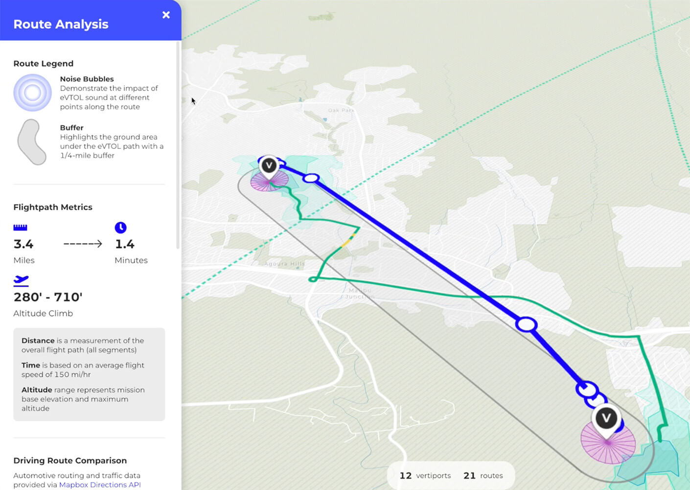
With Airformer, we are studying the intersection of Advanced Air Mobility (AAM) with existing transportation and how this might transform the way we plan cities and transit systems in the future.
The emergence of AAM networks is drawing near as eVTOL companies make advances in their vehicle platforms and prepare to begin service. Airformer demonstrates how geospatial data can help operators, planners, and policy makers study the implications and opportunities for AAM by analyzing the intersections of urban and regional infrastructure, existing transit inter-modalities, and city planning.
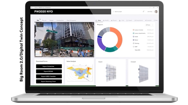
AreaSync is a powerful computing and analysis platform that extracts real-time data from our BIM models and programing applications. This tool lets design teams process and compare complex project data in a visual dashboard, facilitating faster, more informed decisions. It also improves clients’ design processes by helping them visualize project progress in the context of their unique requirements.
Using AreaSync, our teams can focus on delivering exceptional solutions to clients with the confidence that comes from access to real-time data and eliminating manual data analysis. AreaSync ensures that each project is designed according to the client’s programmatic needs while keeping the projected construction cost within the target budget.
We are developing the next generation of architectural “blueprints” to streamline the design process, ensuring projects are delivered faster and within budget constraints. This revolutionary application named Artifact, codeveloped with AIprentice.io, improves the accessibility of graphically dense architectural documentation.
Artifact features a web-based drawing viewer and an AI-enhanced search engine, facilitating a blazing-fast method of searching through past project construction documents across our entire portfolio. This innovative solution stands at the forefront of architectural practice, redefining how our design teams interact with, and benefit from, past solutions. Artifact marks a significant leap towards a more integrated, intelligent design and delivery process.